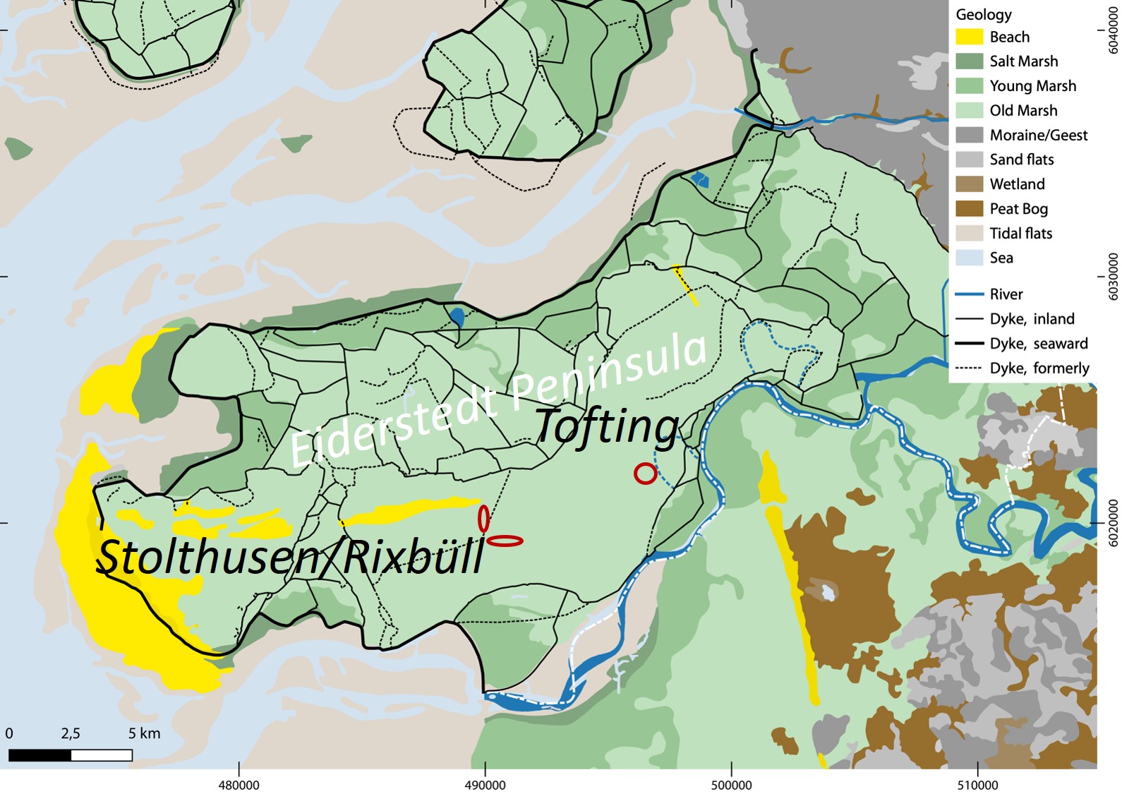
The Eiderstedt peninsula
During the BIP we will survey two archaeological sites on the Eiderstedt peninsula.
Located between the Eider estuary and the North Frisian Wadden Sea, this embanked rural region was formerly a part of an intertidal landscape situated between coastal spits and more elevated inland. Over the past 3000 years, this dynamic landscape has seen fascinating settlement patterns changing in conjunction with environmental evolutions.
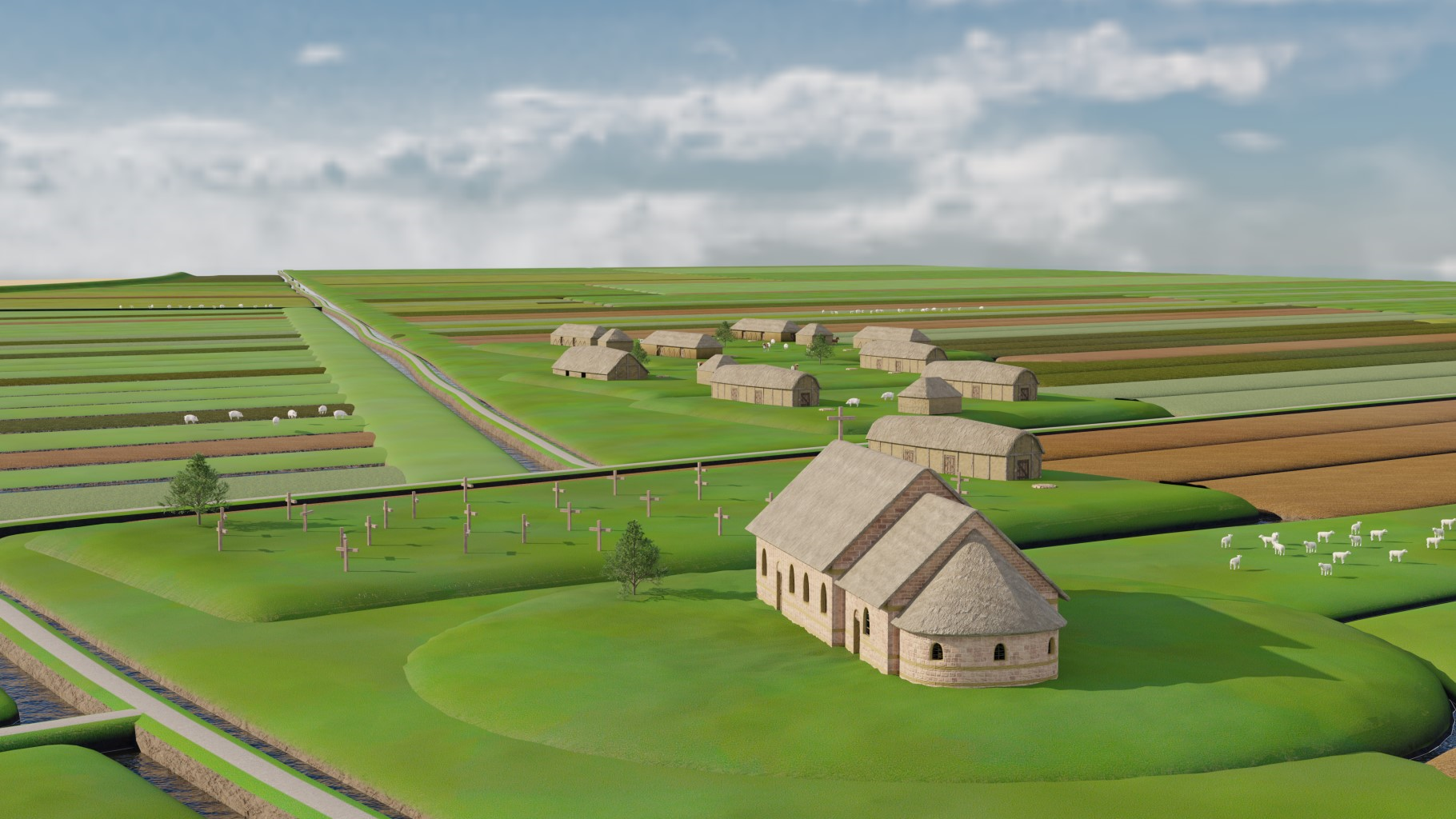
From the 7th/6th century BC onwards, the coastal landscape landed up forming natural levees along the Eider and during the Roman Iron age, many settlements, such as Tofting, were present on these naturally raised the river banks and developed into terps, while the salt marshes seemed inhabitable.
However, up until the the end of the first millennium AD, the coastal barrier was breached and the tidal influence in the landscape increased again.
From the 12th century onwards, land drainage and construction of dykes with settlements attached (e.g. Stolthusen, Rixbüll) gradually reclaimed the land on the sea, which led to the current landscape.
Read more on the coastal archaeology and landscape evolutions of the Eiderstedt peninsula.
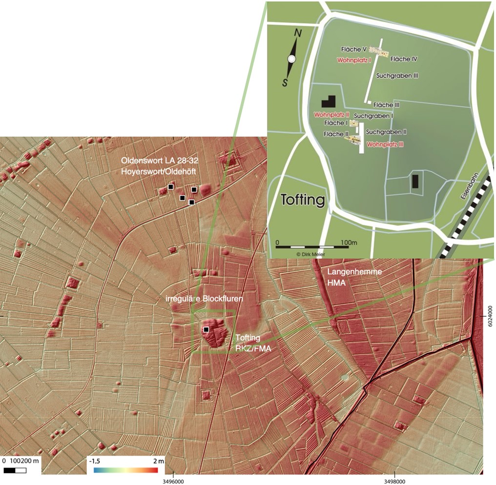
Tofting
Tofting is situated on the embankments of and old river course of the Eider. Around Tofting, the field parcellation is oriented along the natural features of tidal creeks and embankments, creating the typical irregular block parcellation. To the West and the North, the land was boggy and not settled during the Roman Iron Age.
Tofting is a protected monument in Eiderstedt with an overall area of approximately 5.5 hectares. The terp village was partially excavated in the 1940-1950s by Albert Bantelmann. He found a stratified settlement with long-houses dated from the 1st century BC to 6th century AD. Later settlement, probably of the 7th-9th century is seen in the find material, but no building structures of that time have been found yet. These have possibly been integrated within the plow layer. The settlement continuity through the mid 6th-mid7th century, when North Frisia seems to be mostly abandoned, is unclear.
Read more on the archaeology of Tofting .
During the BIP-course, two teams will prospect parts of Tofting to test our survey methods on a stratified terp mound (location).
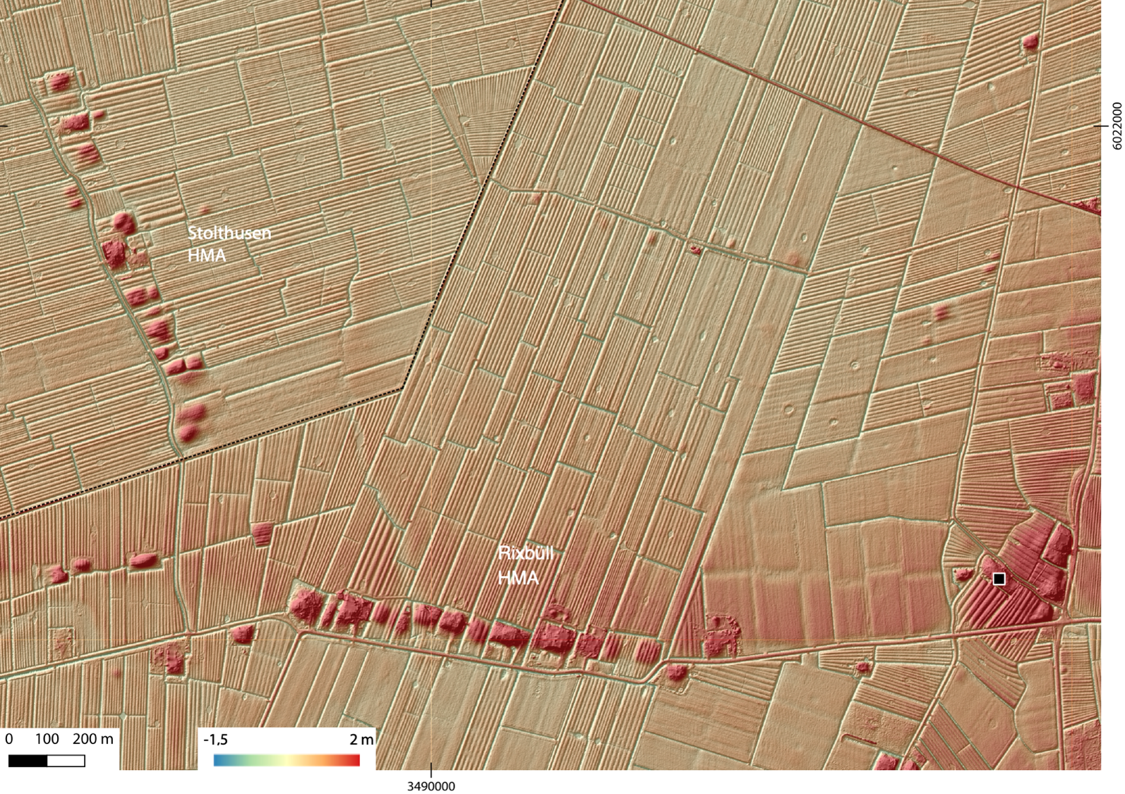
Stolthusen/Rixbüll
In the High-medieval Period, the peat bogs were reclaimed and the long strip parcellation created. Settlements of the High Medieval period form the long rows of small terps along dykes. Stolthusen and Rixbüll are pare of a „Marschhufendorf“, a row of terps midst of a long block of strip parcellation.
One group will survey on each of these High Medieval terp sites (location).